Slavs & Tatars
Drafting defeat: 10th century road maps and 21st century disasters.
Moscow: Slavs & Tatars, [2007]. [16] p. with Russian folktale in inside cover
22 x 31 cm. Edition of 250.

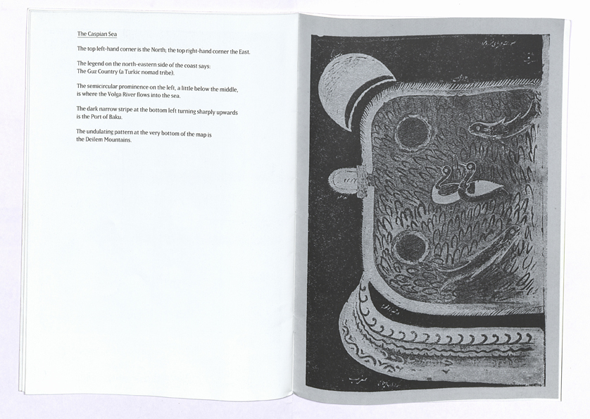
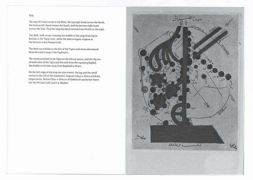
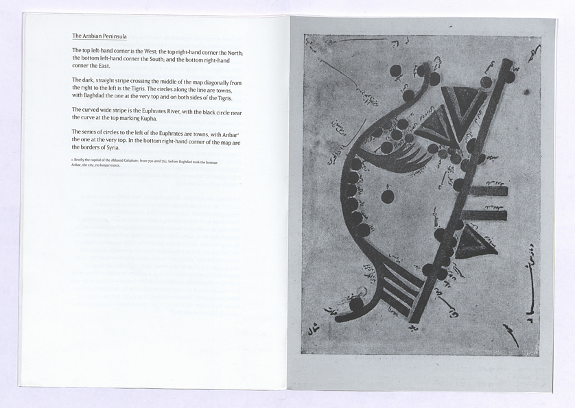
A collection of highly stylized 10th century maps of the Middle East with translations of the legends that accompanied them in a 1933 Soviet edition of Nasser Khosrow’s Safarnameh (Book of Travels).

Maps of The Arabian Peninsula, Egypt, Syria, The Persian Gulf, The Caspian Sea and Iraq by Abu Ishaq Ibrahim Ibn Muhammad Al-Farsi al-Istakhri aka Abu’l Qasim Ubaid’Allah Ibn Khordadbeh aka Al Farsi aka Istakhri.

We have always had an aesthetic weakness for the merciless and brutal banality of bureaucracy. Little did we know that such a weakness would extend to the bureaucrats themselves. The following are reproductions of 10th-century maps by Al-Istakhri (aka Ibn Khordadbeh or Al Farsi) found in a 1933 Soviet edition of Nasser Khosrow’s Safarnameh, or Book of Travels. Both Istakhri and Khosrow were Persian bureaucrats whose legacy was a paper trail of the very antithesis of administration: a regime of curiosity that attempted to describe and map out the Middle East as a coherent geographic and cultural region. Khosrow, an 11th-century Persian poet and philosopher, had led an uneventful life as a tax collector in present day Turkemenistan when one night, in his sleep, a voice told him to leave behind his life of worldly pleasures. Khosrow dropped his avowed weakness for the medieval Merlot and began immediately to plan a seven-year trip through the Caucases and the Caspian to the holy cities of Medina and Mecca. Khosrow was, to some extent, the millenary Muslim equivalent of a 21st-century born-again Christian. Except where the former asked questions, the latter offers only solutions. Where the former travelled extensively, the other is unlikely to have a passport.
Academia, the publisher of Safarnameh, was itself an unorthodox outfit in the Soviet landscape of the early 20th century with a reputation for smart, unexpected titles on relatively limited runs. These maps were drafted during a period when Islamic geography rekindled an interest in Roman and Greek scholarship abandoned by the Christian West. Early draftsmen including Istakhri contributed to An Atlas of Islam, with a visible bias for the Farsi-speaking peoples in the Middle East, where a boundless taste for geometric shapes and symmetry belongs today more to the world of fantasy than fact. Later cartographers such as Al-Idrisi went on to craft intricate maps on improbably luxurious materials (e.g. a 400-pound tablet of silver) with even more improbable names (such as The Gardens of Humanity and the Amusement of the Soul) that would serve for centuries to follow. When Christopher Columbus studied these maps, before setting out to sea, we wonder: did it occur to him that his future would be no less unpredictable than our past?


